For that year we prepared an extremely interesting but also unpredictable track in Northern Pakistan – a bivouac flight from Nanga Parbat to K2. It sounds wild, and it also was. We were putting off this project for 2 years for safety reasons but we still believed that one day there will be peace finally and we will devote to flying around the highest peaks of the world.
Start:
Nanga Parbat – South side of Rupal Face, Northern Pakistan
The expected flight track:
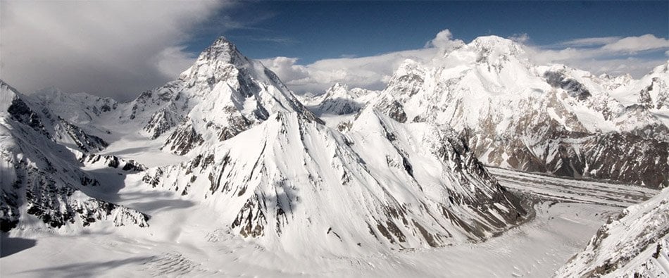
From Nanga Parbat we will continue through Deosai Plateau to Skardu Valley, where the confluence of Indus and Shigar River is. Then we would like to fly across the Braldu Valley and a small town Askole towards to Baltoro Glacier, where we should fly around Masherbrum. The plan for the end is to get in range of Broad Peak and K2. This track over 2 turn points has around 260 km but which way will the mountains let us go finally? It´s in the stars.
Pilots:
Juraj Kleja
Dalibor Carbol
And the result?
We flew 450 km overall in 4 days, in the Pakistani Himalayas, of which by bivouac flight overcame 285 km long track from Hunza Valley above the K2 Base Camp and back to the village Askole. During the flight we overcame the height of 7000 m without any oxygen concentrators and also broke the Czech and Slovak unofficial altitude record. On June 8th 2011 at 4 pm local time we reached the K2 Base Camp. We managed this extremely demanding track in 2 days – just over 11 hours of flight in total.
After a couple days of rest we finally set out in the originally planned launch in the area of Nanga Parbat and flew another 90 km in these beautiful and wild mountains to a city Skardu – in 3 hours and a half.